A look at OpenStreetMap
OpenStreetMap is the free and open geospatial database of the entire world. Anyone can contribute and use the data, for example, to create a custom map. The project began in the UK in 2004, in a response to lack of easily accessible geographic data. The notion was simple and audacious -- take a GPS unit, walk roads in your town, and upload to a commons; convince your friends to do the same, and then their friends, and soon map the entire world.
The project quickly grew around the globe and developed new technical approaches, attracting everyone from enthusiasts to international organizations, filling needs from customized local hiking maps to data for disaster response. There are over 3 million registered users in OpenStreetMap, with over 40,000 contributing every month.
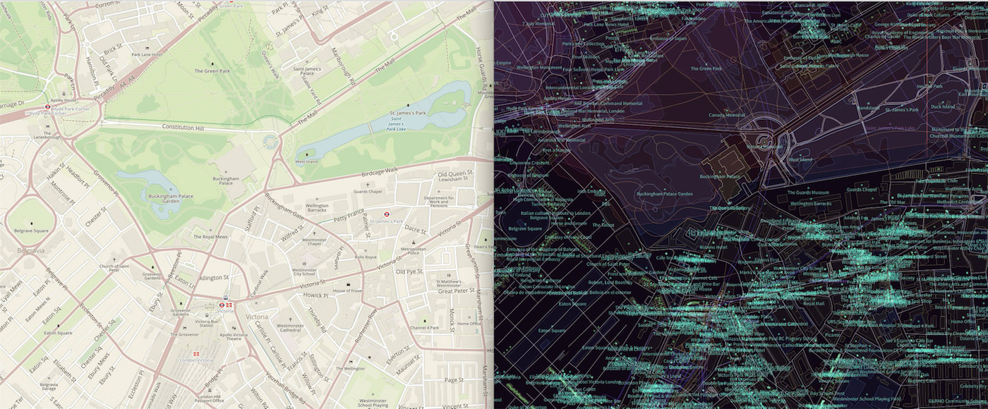 Comparing a map view to underlying geospatial data
 Editing activity in France peaked in 2013, explore editing activity per country here
Crowdsourced data - risks & mitigation

Giving 3M untrained volunteer contributors access to a global database has its merits, but also opens the door to mistakes of beginners and intentional vandalism. From the OpenStreetMap wiki:
Vandalism is intentionally ignoring the consensus norms of the OpenStreetMap community. Simple mistakes and editing errors are not vandalism but may need to be reverted using some of the same tools that are used for vandalism.
With OpenStreetMap data used in commercial applications, directly competiting with proprietary data products such as Google Maps, dedicated teams have set up systems and machine learning algorithms to mitigate such risks.

OSM vandalism protection
The community has created tools to detect and correct vandalism and editing mistakes as soon as possible, globally. In particular, edits from new and unexperienced mappers are taken with a grain of salt and have to be validated by experienced mappers.
Read further on the OpenStreetMap wiki about vandalism and quality assurance.
Vandalism protection at Mapbox
The Mapbox Data team has automated technical solutions in place to keep vandalism at bay in all of OSM to guide which areas (and which contributors) to manually keep an eye on. If there's a user deleting infrastructure randomly or wrong information would be added following a suspicious pattern, this will be picked up and reverted no matter if this a Mapbox customer area of interest or not. We are improving our systems every day to flag different edit patterns around the world. Any suspicious change is quarantined, verified, and fixed.